Consumer Insights
Uncover trends and behaviors shaping consumer choices today
Procurement Insights
Optimize your sourcing strategy with key market data
Industry Stats
Stay ahead with the latest trends and market analysis.
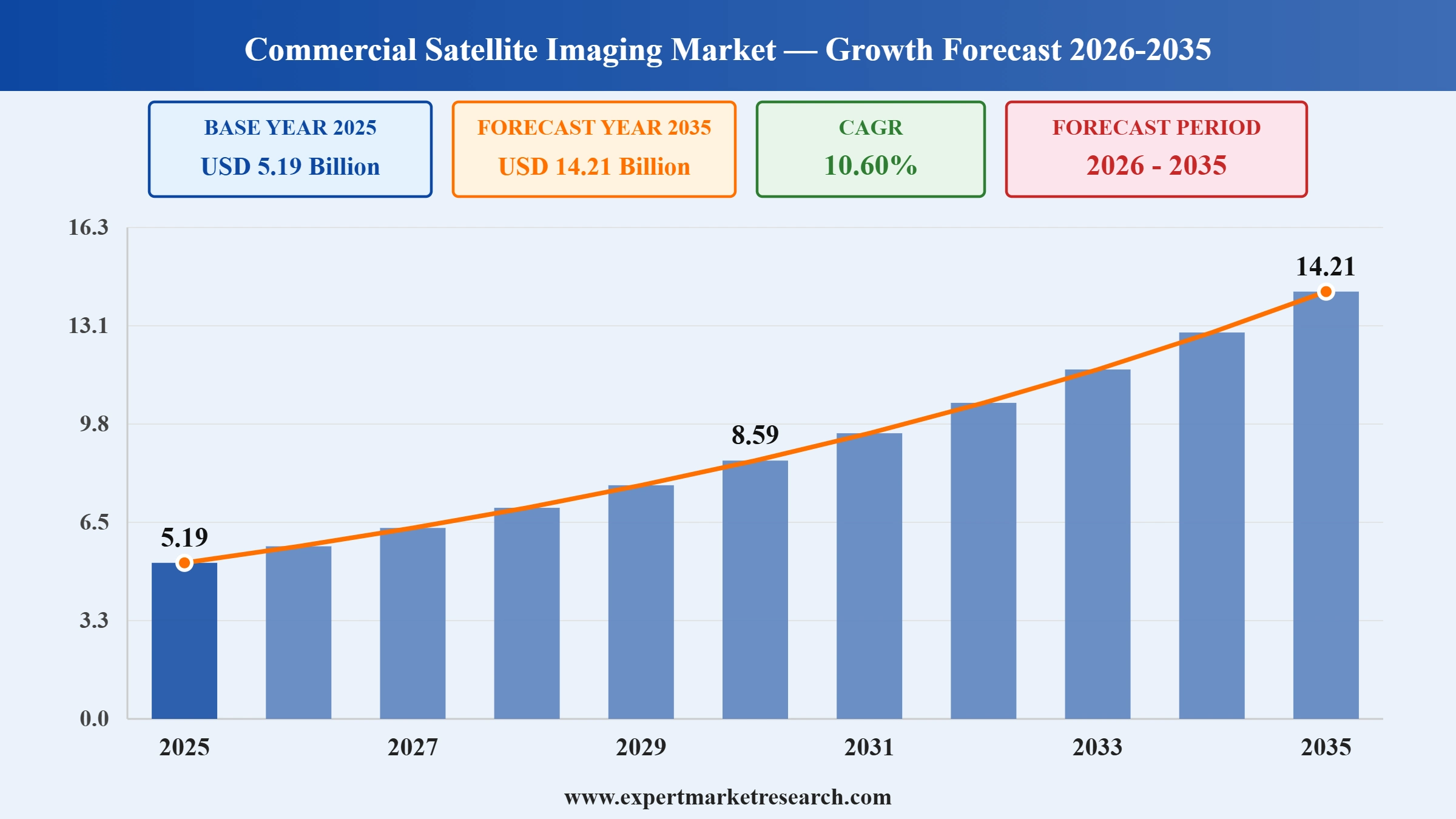
The global commercial satellite imaging market size reached approximately USD 5.19 Billion in 2025. The market is further projected to grow at a CAGR of 10.60% between 2026 and 2035, reaching a value of USD 14.21 Billion by 2035.
Read more about this report - REQUEST FREE SAMPLE COPY IN PDF
| Global Commercial Satellite Imaging Market Report Summary | Description | Value |
| Base Year | USD Billion | 2025 |
| Historical Period | USD Billion | 2019-2025 |
| Forecast Period | USD Billion | 2026-2035 |
| Market Size 2025 | USD Billion | 5.19 |
| Market Size 2035 | USD Billion | 14.21 |
| CAGR 2019-2025 | Percentage | XX% |
| CAGR 2026-2035 | Percentage | 10.60% |
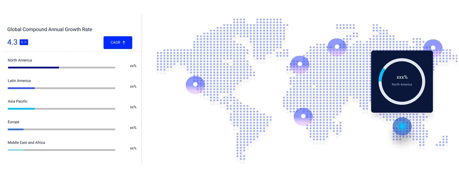
| CAGR 2026-2035 - Market by Region | Asia Pacific | 12.3% |
| CAGR 2026-2035 - Market by Country | India | 14.4% |
| CAGR 2026-2035 - Market by Country | Brazil | 12.4% |
| CAGR 2026-2035 - Market by End Use | Energy | 12.1% |
| CAGR 2026-2035 - Market by Application | Disaster Management | 14.1% |
| Market Share by Country 2025 | UK | 3.6% |
The commercial satellite imaging market is growing because falling launch costs, dense small satellite constellations, and AI-ready analytics are turning high-frequency Earth observation into affordable, decision-grade intelligence for defense, agriculture, insurance, and infrastructure users. The global commercial satellite imaging market reached approximately USD 5.19 billion in 2025 and is projected to grow at a CAGR of 10.60% between 2026 and 2035, reaching USD 14.21 billion by 2035. Much of this expansion reflects a structural shift in which commercial operators now supply imagery once reserved for national space agencies, widening the buyer base far beyond traditional government customers.
On the supply side, reusable rockets and rideshare launches have sharply lowered the cost of reaching orbit, allowing operators such as Planet Labs, BlackSky, Vantor (formerly Maxar), ICEYE, and Satellogic to field larger constellations with faster revisit rates and near-daily global coverage. Synthetic aperture radar (SAR) adds all weather, day and night imaging through cloud and darkness, while higher resolution optical, hyperspectral, and thermal sensors keep expanding the range of activity that can be measured from space.
On the demand side, defense and intelligence agencies such as the NRO and NGA are anchoring long term commercial imagery contracts, while adoption accelerates across agriculture, insurance, energy, maritime, and disaster response. The integration of artificial intelligence and analysis-ready data (ARD) is a decisive catalyst, moving value from raw pixels toward automated change detection and insights that customers can use without specialist geospatial skills and shifting the market from one-off tasking toward persistent, subscription based monitoring.
The Expert Market Research's report titled “Commercial Satellite Imaging Market Report and Forecast 2026-2035” offers a detailed analysis of the market based on the following segments:
Market Breakup by Application
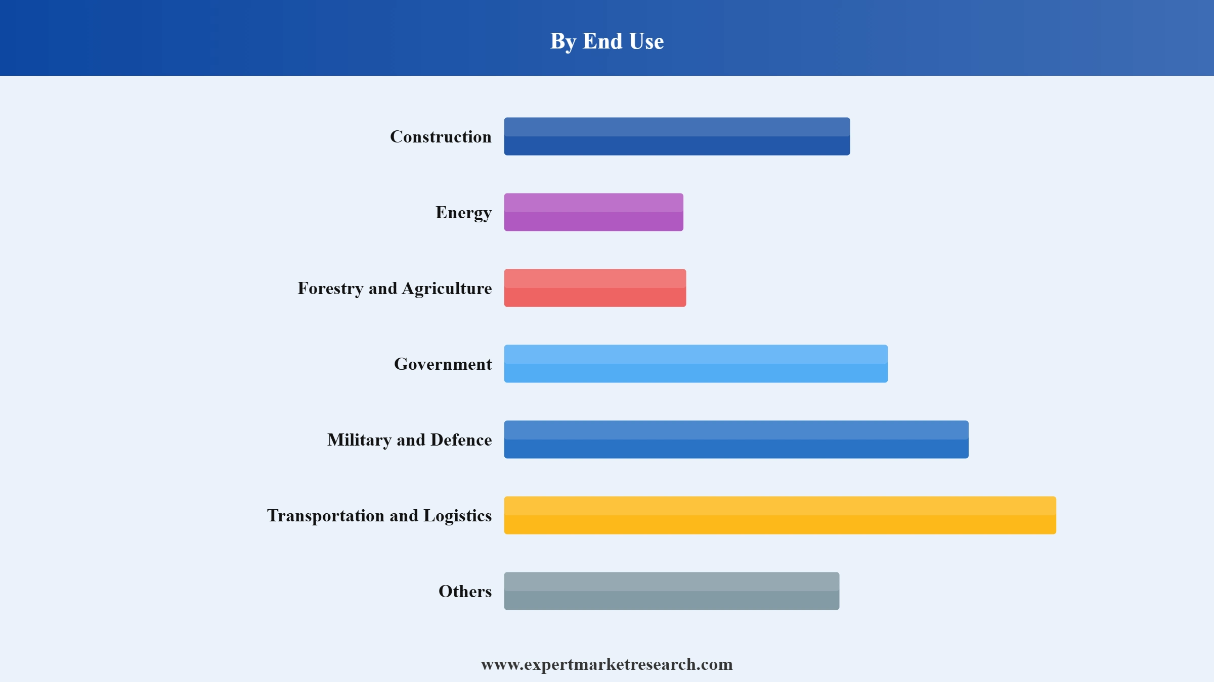
Market Breakup by End Use
Market Breakup by Region
Read more about this report - REQUEST FREE SAMPLE COPY IN PDF
Government accounted for a significant commercial satellite imaging market share during the historical period and is expected to expand further over the forecast period. The precise information and high-quality image provided by commercial satellite imaging assists government agencies to save lives, protect properties, and to strengthen economic stability within geographical limits. Moreover, the images are also used by the governments to run a regulatory check on land management, population impact, and carbon management, among others.
Read more about this report - REQUEST FREE SAMPLE COPY IN PDF
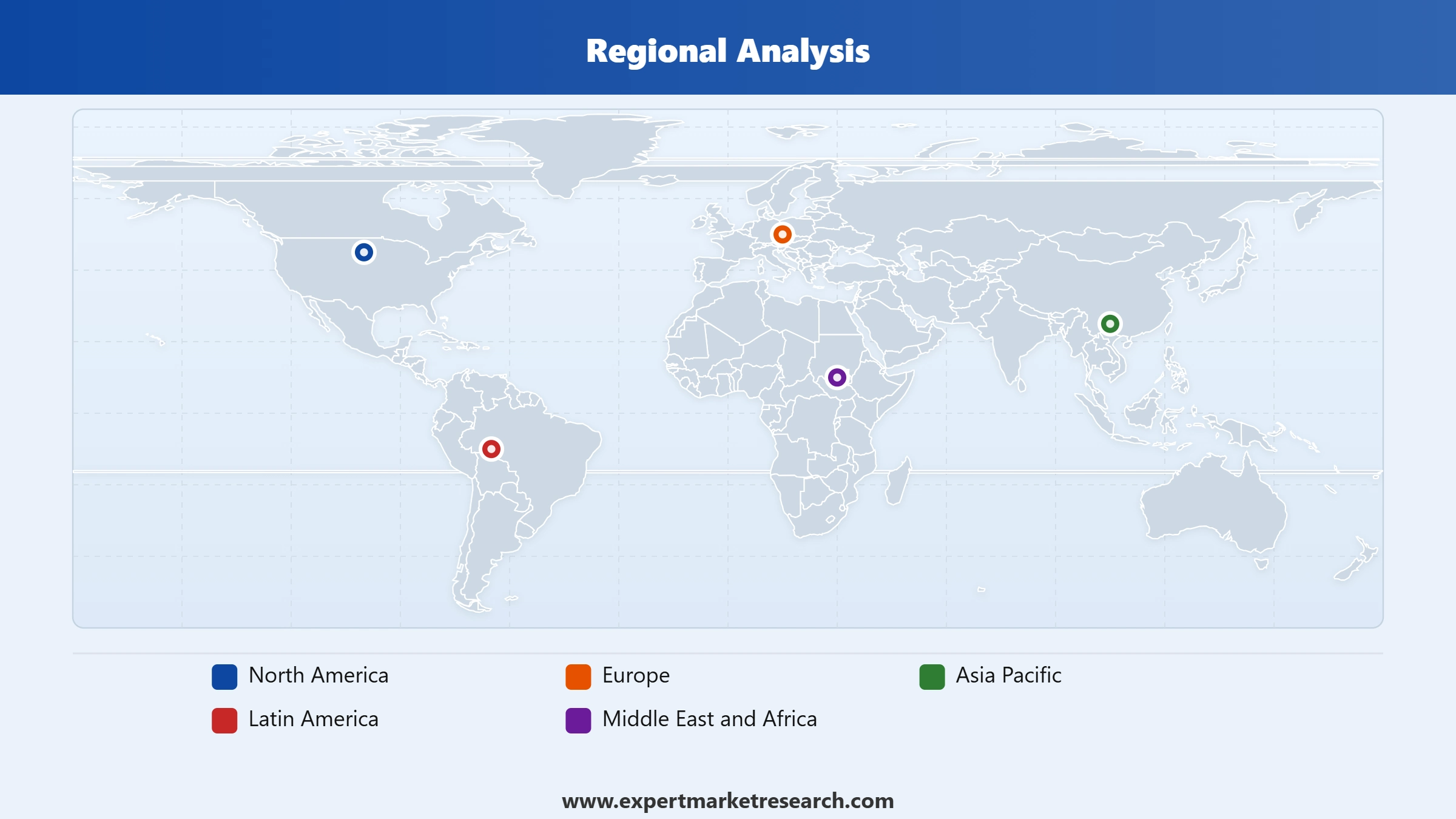
North America holds a significant share of the market owing to the strong presence of leading market players. The availability of modern infrastructure and increased spendings on space programs coupled with rising the demand for commercial satellite imaging from various governments in the region is further fuelling the commercial satellite imaging market growth.
The Asia Pacific is anticipated to witness significant growth due to rising investments by governments of countries including China, India, and Japan, among others in commercial satellite imaging, to ensure national security.
Read more about this report - REQUEST FREE SAMPLE COPY IN PDF
The comprehensive EMR report provides an in-depth assessment of the market based on the Porter's five forces model along with giving a SWOT analysis. The report gives a detailed analysis of the following key players in the global market, covering their competitive landscape and latest developments like mergers, acquisitions, investments, and expansion plans.
Planet Labs PBC was founded in 2010 and is headquartered in California, United States. The data analytics and aerospace company, builds small satellites and delivers information about the planet.
DigitalGlobe Inc., a commercial earth imagery content provider, was founded in 1992 and is headquartered in Colorado, United States. The company provides advanced geospatial services and operates civilian remote sensing spacecrafts.
Galileo Group, Inc. provides advanced remote sensing solutions using data fusion, hyperspectral imaging, and LIDAR, among others. The company was founded in 1998 and is headquartered in Florida, United States.
Other commercial satellite imaging market players include SpaceKnow Inc., Maxar Technologies Inc, L3Harris Corporation Inc., BlackSky Technology Inc., Imagesat International (I.S.I) Ltd., and European Space Imaging (EUSI) GmbH, among others.
*Please note that this is only a partial list; the complete list of key players is available in the full report. Additionally, the list of key players can be customized to better suit your needs.*
The commercial satellite imaging market faces persistent regulatory and operational challenges. In the United States, operators must hold licences from NOAA's Commercial Remote Sensing Regulatory Affairs office under the Land Remote Sensing Policy Act, which can cap resolution or impose temporary restrictions on national security grounds. Optical imagery remains limited by cloud cover, illumination, and revisit gaps, while rapid low Earth orbit constellation growth heightens orbital congestion and collision avoidance concerns monitored by the U.S. Space Force.
Several structural restraints temper this growth. Building and operating Earth observation constellations is capital intensive and export control regimes notably the International Traffic in Arms Regulations (ITAR) and Export Administration Regulations (EAR) limit cross border transfer of sensitive technologies and imagery. Freely available medium-resolution data from the European Space Agency's Copernicus Sentinel missions and the USGS–NASA Landsat programme reduces willingness to pay for comparable products, while reliance on defence and intelligence buyers concentrates revenue among relatively few customers.
Opportunities within the commercial satellite imaging market are widening as analysis ready data and artificial intelligence lower the expertise needed to interpret imagery, unlocking uses across agriculture, insurance, energy, maritime awareness, and infrastructure. Public programmes such as NASA's Commercial SmallSat Data Acquisition initiative and expanding National Reconnaissance Office procurement reinforce demand, while climate disclosure and disaster response needs supported by the International Charter on Space and Major Disasters favour wider adoption of radar, hyperspectral and thermal sensing.


Upto 15% Off
USD
$2499 $2249
$3999 $3599
$4999 $4249
$5999 $5099


*While we strive to always give you current and accurate information, the numbers depicted on the website are indicative and may differ from the actual numbers in the main report. At Expert Market Research, we aim to bring you the latest insights and trends in the market. Using our analyses and forecasts, stakeholders can understand the market dynamics, navigate challenges, and capitalize on opportunities to make data-driven strategic decisions.*
The market reached a value of approximately USD 5.19 Billion in 2025.
The market is projected to grow at a CAGR of 10.60% between 2026 and 2035.
The market is estimated to witness a healthy growth in the forecast period of 2026-2035 to reach USD 14.21 Billion by 2035.
The major market drivers include rising investments by various governments towards development of satellite imaging technologies and increased demand from the defence sector.
The key trends fuelling the growth of the market include growing requirement for quick response in emergency situations, increasing security concerns, and rising need for natural resource management.
The major regions in the market are North America, Europe, the Asia Pacific, Latin America, and the Middle East and Africa.
The significant end uses of commercial satellite imaging include construction, energy, forestry and agriculture, government, military and defence, and transportation and logistics, among others.
The key players in the market are Planet Labs PBC, DigitalGlobe Inc., Galileo Group, Inc., SpaceKnow Inc., Maxar Technologies Inc, L3Harris Corporation Inc., BlackSky Technology Inc., Imagesat International (I.S.I) Ltd., and European Space Imaging (EUSI) GmbH, among others.
Explore our key highlights of the report and gain a concise overview of key findings, trends, and actionable insights that will empower your strategic decisions.
| REPORT FEATURES | DETAILS |
| Base Year | 2025 |
| Historical Period | 2019-2025 |
| Forecast Period | 2026-2035 |
| Scope of the Report |
Historical and Forecast Trends, Industry Drivers and Constraints, Historical and Forecast Market Analysis by Segment:
|
| Breakup by Application |
|
| Breakup by End Use |
|
| Breakup by Region |
|
| Market Dynamics |
|
| Competitive Landscape |
|
| Companies Covered |
|
Datasheet
One User
USD 2,499
USD 2,249
tax inclusive*
Single User License
One User
USD 3,999
USD 3,599
tax inclusive*
Five User License
Five User
USD 4,999
USD 4,249
tax inclusive*
Corporate License
Unlimited Users
USD 5,999
USD 5,099
tax inclusive*
*Please note that the prices mentioned below are starting prices for each bundle type. Kindly contact our team for further details.*
Flash Bundle
Small Business Bundle
Growth Bundle
Enterprise Bundle
*Please note that the prices mentioned below are starting prices for each bundle type. Kindly contact our team for further details.*
Flash Bundle
Number of Reports: 3
20%
tax inclusive*
Small Business Bundle
Number of Reports: 5
25%
tax inclusive*
Growth Bundle
Number of Reports: 8
30%
tax inclusive*
Enterprise Bundle
Number of Reports: 10
35%
tax inclusive*
How To Order

Select License Type
Choose the right license for your needs and access rights.

Click on ‘Buy Now’
Add the report to your cart with one click and proceed to register.

Select Mode of Payment
Choose a payment option for a secure checkout. You will be redirected accordingly.
Strategic Solutions for Informed Decision-Making
Gain insights to stay ahead and seize opportunities.
Get insights & trends for a competitive edge.
Track prices with detailed trend reports.
Analyse trade data for supply chain insights.
Leverage cost reports for smart savings
Enhance supply chain with partnerships.
Connect For More Information
Our expert team of analysts will offer full support and resolve any queries regarding the report, before and after the purchase.
Our expert team of analysts will offer full support and resolve any queries regarding the report, before and after the purchase.
We employ meticulous research methods, blending advanced analytics and expert insights to deliver accurate, actionable industry intelligence, staying ahead of competitors.
Our skilled analysts offer unparalleled competitive advantage with detailed insights on current and emerging markets, ensuring your strategic edge.
We offer an in-depth yet simplified presentation of industry insights and analysis to meet your specific requirements effectively.