Rise of AI-Based Wildfire Detection Technologies in Global Fire Surveillance
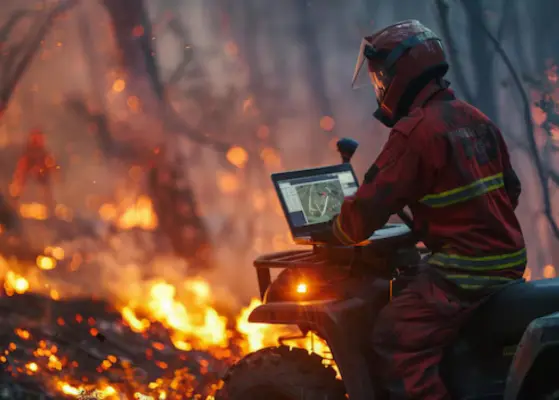
Wildfire incidents are becoming more frequent and more intense. In response, both governments and private organizations are re-evaluating how fires are detected at their earliest stages. AI-based detection systems are now moving beyond experimental settings and are being actively deployed as practical tools in high-risk areas.
Fire surveillance companies are not just making sensors anymore. They are aiming to cut down response times from hours to minutes. That is where AI plays a major role. By combining live data with forecasts, the systems help officials respond before mishaps occur.
Real-Time Detection Is Becoming a Competitive Advantage
Traditional fire detection methods have largely relied on human observation, supplemented by satellite data that is often subject to time delays. However, advanced AI-powered systems of the present days are analyzing camera, satellite, and sensor inputs in a matter of seconds. Processes that used to take hours have been reduced to seconds.
One of the companies that has brought out solar-powered gas sensors capable of noticing wildfire smoke at an early stage is Dryad Networks. In March 2025, the company deployed IoT sensors across forests, enabling real-time connectivity and early wildfire detection, improving response times and reducing damage. Companies like Pano AI are also rolling out AI-driven camera ranges in key areas of the United States and Australia. The setup combines wide-angle lenses with machine learning to spot smoke signs early.
Integration with Satellite Data Is Changing the Game
For a long time, wildfire monitoring has been heavily dependent on satellite imagery, but currently artificial Intelligence-assisted models are turning satellite data into more useful information. NASAs Fire Information for Resource Management System (FIRMS) remains at the core of satellite fire data usage. However, some of the latest platforms are taking advantage of the combination of AI and satellite data. The companies that develop these systems also integrate other data sources such as ground level sensors and weather conditions with satellite feeds for a more comprehensive depiction of fire threats. For instance, specifically dedicated and built for wildfire detection OroraTech, a German startup, launched its constellation of thermal imaging satellites in March 2025. Through these satellites, the company is able to generate high-resolution thermal data. This data is then processed through the AI model in order to identify heat anomalies.
Predictive Analytics Is Where the Real Value Lies
Artificial intelligence systems rely on a variety of data types to make their predictions, including historical fire records, vegetation patterns, humidity levels, and wind information. This gives the companies the opportunity to forecast locations where fires are more probable. While the predictions are not always fully accurate, they continue to improve.
Companies like Descartes Labs have been developing wildfire risk forecasting models utilizing geospatial analytics. Their platform is capable of analyzing extensive datasets to determine areas with elevated fire probabilities. In fact, governments and insurance companies are the major users of such tools, mainly for risk evaluation and planning.
Moreover, Google has developed an AI-powered system for tracking wildfire boundaries. It is capable of creating fire spread maps in real-time. Google rolled out this service for fire-prone regions, thereby assisting emergency responders in comprehending the patterns of fire movement faster than before.
The aim of such predictive skills goes beyond the mere prevention of the situation. It is also about the efficient allocation of resources. Once it is known where a fire is likely to start, agencies can deploy their equipment and personnel in a more efficacious manner.
Adoption Is Expanding Across Public and Private Sectors
Traditionally, government agencies were the main users of wildfire detection technologies. However, private companies, particularly those in the energy, utilities, and forestry sectors, are collectively funding these systems. Power companies are under increasing pressure to minimize wildfire threats caused by transmission lines. A significant number of global companies are implementing AI-powered monitoring systems to ensure safety along their infrastructures. For example, Pacific Gas and Electric (PG&E) is incorporating AI tools for surveillance of vegetation and identification of potential fire hazards around power lines. Besides power companies, insurance providers are entering this market space. They use AI-driven risk models to determine the level of wildfire exposure. This results in even more demand for state-of-the-art detection and prediction tools.
To understand how aerial response technologies complement early detection systems, explore the Firefighting Drone Market Report.
Existing Challenges That Hinder Market Growth
There are always going to be limitations in spite of the progress made. False alarms continue to be a significant challenge, as AI systems can misinterpret fog, dust, or industrial smoke as fire indicators, leading to false positives and unnecessary resource deployment.
Besides, there is a matter of infrastructure. Deploying and maintaining sensors and camera networks across vast forest landscapes requires substantial investment, ongoing maintenance, and coordination with local authorities. Improving the accuracy of the models and at the same time reducing the number of false alarms is becoming the main focus area. Companies are favoring the development of hybrid systems that utilize AI and human verification in order to find a balance between speed and reliability.


Share